Where the Sea Meets the Sky
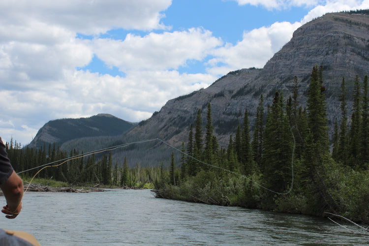
From the islands of Haida Gwaii, where the wilderness rules and a strong First Nations culture maintains an unbreakable bond with nature, to the rugged peaks of the Rocky Mountains, world-famous for their alpine majesty, BC is a land of extreme beauty. In the western part of the province, the Coast Mountains rise right out of the ocean, their slopes covered in lush temperate rainforest, while moving inland brings you to the sweeping Chilcotin steppe, giving way to the vast and powerful backcountry of the north. To the south, the Okanagan is known for its many beaches, lakes and desert-like landscape, while further east the Kootenays are home to one of the world's richest and most vibrant mountain cultures. No matter which corner of the province you are exploring, BC is as exciting a destination as you can find anywhere in the world.
British Columbia Backroad GPS at a Glance:
- Combining city and backcountry navigation with enhanced outdoor recreation information, this product amalgamates all of BC into one Backroad GPS Map, including our Vancouver Island, Vancouver, Coast and Mountains, Cariboo Chilcotin Coast, Northern BC, Okanagan and Kootenay Rockies Backroad Mapbook titles.
- Close to 685,000 km of our backroads network combined into one map, including close to 200,000 km of routable roads, including close to 23,000 km of newly enhanced and named Forest Service Roads in Version 2019.
- Lake Bathymetry depth contour for 1,800+ fishing lakes, rivers, and streams in BC
- Clearly marked private leased land for anglers and hunters.
- Searchable Oil and Gas LSD Grid Locations, Compressor Stations, Gas Plants, Wellsites and other resource facilities.
- Marked Wildlife Management Units (WMUs) for hunters.
- Tens of thousands of kilometres of multi-use hiking, biking and cross-country skiing trails and paddling routes, with marked trailheads and access points/portages, including 1,500+ km of added multi-use trails and close to 400 km of new paddling routes in Version 2019.
- Over 4,400 km of new ATV and snowmobile routes in Version 2019.
- Tens of thousands of fishing hotspots, parks and conservation areas, campsites, hunting areas, winter recreation areas and more.
- Over 31,000 land and water geographic features.
- Thousands of railway corridor mile markers.
- Improved First Nations reservation coverage.
- Updated snowmobile route line style for easier navigation.
So Much More Than Just Maps!
Backroad Mapbooks industry-leading, Garmin-licensed British Columbia GPS Maps are the most detailed, comprehensive and up-to-date GPS maps available on the market. These are the maps of choice for recreation, industry, and search-and-rescue, with 3D views, shaded relief and countless geographic and activity based points-of-interest. Updated annually, these GPS maps are Garmin licensed for compatibility with Garmin GPS and Garmin Basecamp. Available in Micro SD format, these British Columbia GPS Maps are easy to install and use and bring you all of the detail of our wildly popular Backroad Mapbook series directly to your GPS device or computer. Keep your adventure rolling with the latest topographic data, routable roads, oil and gas data, Wildlife Management Units, trails, rec sites, paddling routes, scenic viewpoints and so much more. With the latest edition of our British Columbia GPS Maps in hand, your options for adventure are limitless.
British Columbia Backroad GPS Map Features
- Garmin-licensed & compatible with Garmin GPS™, Basecamp™, MapSource™ and RoadTrip™.
- Includes all standard Garmin features such as Find tool, city navigation and more.
- Preloaded 1:20,000 / 1:50,000 base scale seamless topographic maps.
- Provides 3D views and the highest level of map detail available on select Garmin GPS™ units and Basecamp™.
- Showcases private/lease land areas.
- The most complete Resource, Industry, and Logging road coverage available for British Columbia.
- Extensive routable road network including City, Resource, and Industry Roads.
- Highlights tens of thousands of kilometres of trail systems, including defined ATV, Paddling, Snowmobile, Long distance & Multi-use trails.
- Features smart background & Searchable Wildlife Management Units (WMUs).
- Includes National, Provincial, Regional, and other Parks & Campsites.
- Extras like Lake & Stream Fishing information with boat launches, paddling access points, bathymetric depths, and more.
- Searchable BRMB descriptions and activity information for fishing, paddling, parks, trails and more.
- Includes Oil and Gas LSD Grid Locations, Compressor Stations, Gas Plants, Wellsites and other Resource Facilities.
- Thousands of Searchable cities, Geographic Land, and Water features.
- Industry leading cartographic contours and shaded relief for all of British Columbia
- And much more!
Explore More by Using the Search Function
Search highly descriptive point of interest and recreation site write ups geo-referenced from our popular Backroad Mapbook guide book series.
Note: Backroad Extras or Points of Interest can be searched by selecting the Where To/Find > Extras and then Go! option, or read what each site offers through the More option.
Unique Road Classifications
Unique to the Backroad GPS Maps are our enhanced road classifications that help you distinguish the highways from the logging roads and the main roads from the side roads. This extra level of road classification helps you to know which roads can be driven in a car and which ones should be left to a four-wheel drive vehicle or ATV.
In addition, we offer more recreational points and symbols than any other map source. From RV accessible to backcountry campsites, hiking to snowmobiling trailheads, fishing to paddling access points, we have your adventure covered. Our area classifications include mines and gravel pits, conservation and restricted areas, and a host of other features that help you to see where you can play.
Get More Roads and Trails
Boasting more roads and trails than any other GPS maps, our road tracking classifications allow you to easily distinguish main industrial or logging roads from rarely travelled unclassified roads. Access close to 200,000 km of routable city and rural roads, with 3 levels of industry roads (forest service, resource and recreational) along with over 485,000 km of non-routable roads including unclassified and private roads. Over 41,000 km of multi-use trails are separated for use by hikers, bikers and horseback riders, along with close to 40,000 km of ATV and Snowmobile motorized trails. Trails are updated and expanded with the help of government agencies, off-road clubs and customers who contribute their own data.
British Columbia Road and Trail Highlights:
- Close to 200,000 kilometres of Routable Roads including city roads, rural roads, and 3 levels of Logging Roads (Industrial, Resource and Winter Access Roads)
- Over 485,000 kilometres of non-routable roads including Old Logging Roads, Unclassified Roads, Alleyways, Leased and Private Roads and more
- Close to 42,000 kilometres of Trails for hikers, mountain bikers, horseback riders, cross-country skiers, including over 2,000 kilometres of the Trans Canada Trail
- Over 20,000 kilometres of Snowmobile Trails
- Close to 20,000 kilometres of ATV-QUAD Trails
- 17,000+ kilometres of Paddling Routes
Point of Interest (POI)
Unique to the Backroad BC GPS Maps are our Custom or Backroad POI sets. Within BC we have over 265,000 searchable points including Oil and Gas LSD Grid Locations, PNG Grid Locations, Township Quarter Section Grid Locations, Compressor Stations, Gas Plants, other Resource Facilities and Backroad POI sets. Customers can search for Oil and Gas Resource Facility information by selecting Where To/Find > Cities and then by entering the full LSD Grid reference for Facilities near Fort St. John (ex: 6-28-85-18-W6), or by entering the full PNG Grid reference for Facilities elsewhere in the province (ex. D-83-I-94-J-10). Backroad POIs can be searched by selecting the Where To/Find > Extras and then Go! option, or read what each site offers through the More option. This added feature to our GPS Maps gives you the descriptions or write-ups of most recreation sites that have been geo-referenced from the popular Backroad Mapbook guidebook series.
British Columbia Custom POI Highlights
- 265,000 searchable Oil and Gas LSD Grid locations, PNG Grid Locations
- 225+ BC Wildlife Management Units (WMU) for hunters
- Fishing Lakes and Rivers with over 3,500 locations with descriptions and fish species
- Close to 950 Boat Launch locations
- Close to 5,300+ Trails with front country and backcountry locations and descriptions
- ATV Trails with close to 500 trailhead locations and descriptions
- Snowmobile Trails with over 400 trailhead locations and descriptions
- Parks with over 3,000 National, Provincial and Regional Park locations and descriptions
- Recreation Areas with over 1,200 locations and descriptions
- Close to 1,200 Backcountry campsites
- Over 1,300 Campground and Picnic locations
- Paddling with over 580 paddling route access points descriptions and portage locations
- Wildlife Viewing with close to 1,000 locations and descriptions
- Over 370 Winter Recreation Sites and Downhill Ski Areas
- Over 2,100 City, Town and Community locations
- Over 900 Compressor Stations
- Close to 100 Gas Plants
- Over 13,000 Resource Facilities
- Over 60,000 searchable land and water geographic features
- Over 370 Backcountry Huts and Cabins
Backroad Extras
Backroad Extras are where you find all the POI information specific to our Backroad GPS Maps.
British Columbia Categories:
- Backroad Attractions
- ATV-OHV Trails
- Backcountry Camps
- Boat Launches
- Border Monuments
- Campsites
- Cities
- Compressor Stations (found under city search)
- Fishing Lakes, Rivers, Streams, Ocean
- Fishing Resorts-Outfitters
- Gas Plants (found under city search)
- Gates
- Geocaching
- Golf Courses
- Hot Springs
- Hunting Areas
- Huts
- Land Features
- Lodging
- Oil and Gas LSD Grid Locations, PNG Grid Locations (found under city search)
- Marinas
- Paddling Access
- Paddling Routes
- Parks – Provincial – National - Urban
- Picnic Areas
- Portage Locations
- Public Services
- Recreation Sites
- Resource Facilities
- Restaurants
- Rivers and Creeks
- Ski Areas
- Snowmobile Routes
- Trails
- Transportation Services
- Visitor Information
- Water Features
- Waterfalls
- Wildlife Viewing
- Winter Recreation
Updates
We are always looking for ways to improve our products. Whether it is map updates, new trails, or road closures, we welcome any new information and feedback.
To submit a map update, you will need the following information:
- Publication Year
- A .gpx file or .zip file (if submitting more than one gpx file at a time)
- Map Coordinate (if applicable)
- Your comments regarding the suggested change/s
If you have more than one file to submit, please do so by uploading a zipped file containing all the .gpx files. All tracks and waypoints received will earn points for free updates in your account.
Mises à jour
Nous cherchons continuellement à améliorer nos produits. Nous accueillons à bras ouvert toutes suggestions et informations à propos de mise à jour de carte, d'ajout de sentiers ou d'annonce de route fermée à la circulation.
Pour soumettre une demande de mise à jour d'une carte, il vous faudra les informations suivantes:
- Année de publication
- Un fichier .gpx ou .zip (si vous soumettez plus d'un fichier à la fois)
- Coordonnées de carte (le cas échéant)
- Vos commentaires et changements suggérés.
Si vous avez plus d'un fichier à soumettre, veuillez le faire sous forme de fichier zippé contenant tous les fichiers .gpx. Toutes les trajectoires et balises reçues vous feront gagner des points pour bénéficier de mises à jour gratuites de votre compte.