


From Peaks to Plains
Alberta is a land as diverse as it is beautiful, flanked by some of the world’s tallest and most iconic mountains on one side and the sprawling Canadian prairies on the other. Below the famous Rockies, the foothills contain endless opportunities for camping, fishing, ATVing and more. As you move north, the wilderness becomes more pronounced and forest and muskeg dominate the landscape. To the south, the grasslands and farmer’s fields reflect the province’s rich ranching and agricultural heritage. And wildlife is found in abundance throughout the province, from grizzly bear to snowy owl and pronghorn antelope.
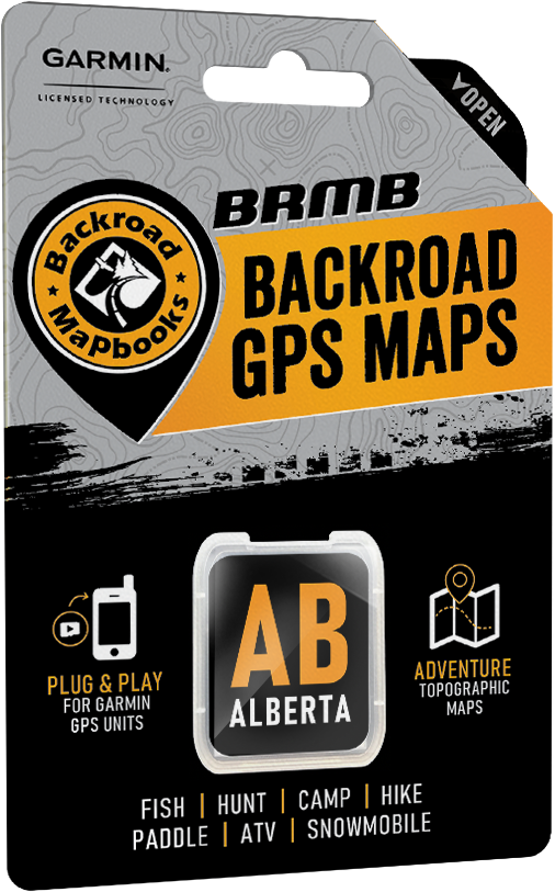
Alberta Backroad GPS at a Glance:
- Designed for industry use and outdoor recreationists, this product combines all of Alberta into one Backroad GPS Map, including our Southern Alberta, Central Alberta and Northern Alberta Backroad Mapbook titles.
- Over 410,000 km of our backroads network combined into one map, including close to 320,000 km of routable roads.
- Searchable Oil and Gas LSD Grid Locations, Compressor Stations, Gas Plants, Wellsites and other Resource Facilities.
- Address and Township & Range Search for easier than ever navigation.
- Lake Bathymetry depth contour for over 150 fishing lakes, rivers, and streams.
- Marked Wildlife Management Units (WMUs) for hunters.
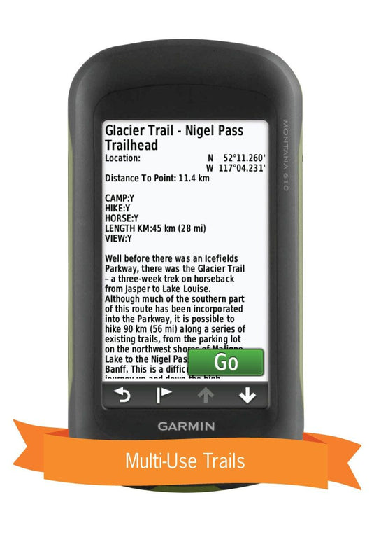
- Tens of thousands of kilometres of multi-use hiking, biking and cross-country skiing trails and paddling routes, with marked trailheads and access points/portages.
- Over 2,800 km of new ATV and snowmobile trails in Version 2019.
- Thousands of fishing hotspots, parks and conservation areas, campsites, hunting areas, winter recreation areas and more.
- Over 16,000 land and water geographic features.
- Enhanced cartography for improved display of parks, conservation areas, Crown land, creeks and activity Points of Interest.
- Improved snowmobile route lines, First Nations reserve coverage and railway corridor mile markers.
So Much More Than Just Maps!
Backroad Mapbooks’ industry-leading, Garmin-licensed Alberta GPS Maps are the most detailed, comprehensive and up-to-date GPS maps available on the market. These are the maps of choice for recreation, industry, and search-and-rescue, with 3D views, shaded relief and countless geographic and activity based points-of-interest. Updated annually, these GPS maps are Garmin licensed for compatibility with Garmin GPS and Garmin Basecamp. Available in Micro SD format, these Alberta GPS Maps are easy to install and use and bring you all of the detail of our wildly popular Backroad Mapbook series directly to your GPS device or computer. Keep your adventure rolling with the latest topographic data, routable roads, oil and gas data, Wildlife Management Units, trails, rec sites, paddling routes, scenic viewpoints and so much more. With the latest edition of our Alberta GPS Maps in hand, your options for adventure are limitless.
Alberta Backroad GPS Map Features
- Garmin-licensed & compatible with Garmin GPS™, Basecamp™, MapSource™ and RoadTrip™.
- Includes all standard Garmin features such as Find tool, city navigation and more.
- Preloaded 1:20,000 / 1:50,000 base scale seamless topographic maps.
- Provides 3D views and the highest level of map detail available on select Garmin GPS units and Basecamp™.
- Compatible with the brand new Garmin 66i unit and inReach technology.
- The most complete Resource, Industry, and Logging road coverage available for Alberta
- Extensive routable road network including City, Resource, and Industry Roads.
- Highlights tens of thousands of kilometres of trail systems, including defined ATV, Paddling, Snowmobile, Long distance & Multi-use trails.
- Features smart background & Searchable Wildlife Management Units (WMUs) for hunters.
- Includes National, Provincial, Regional, and other Parks & Campsites.
- Extras like Lake & Stream Fishing information with boat launches, paddling access points, bathymetric depths, and more.
- Searchable BRMB descriptions and activity information for fishing, paddling, parks, trails and more.
- Thousands of Searchable cities, Geographic Land, and Water features.
- Includes Oil and Gas LSD Grid Locations, Compressor Stations, Gas Plants, Wellsites and other Resource Facilities.
- Industry leading cartographic contours and shaded relief for all of Alberta.
- Features Address and Township & Range searching to aid navigation.
- And much more!
Explore More by Using the Search Function
Search highly descriptive point of interest and recreation site write ups geo-referenced from our popular Backroad Mapbook guide book series.
Note: Backroad Extras or Points of Interest can be searched by selecting the Where To/Find > Extras and then Go! option, or read what each site offers through the More option.
Unique Road Classifications
Unique to the Backroad GPS Maps are our enhanced road classifications that help you distinguish the highways from the logging roads and the main roads from the side roads. This extra level of road classification helps you to know which roads can be driven in a car and which ones should be left to a four-wheel drive vehicle or ATV.
In addition, we offer more recreational points and symbols than any other map source. From RV accessible to backcountry campsites, hiking to snowmobiling trailheads, fishing to paddling access points, we have your adventure covered. Our area classifications include mines and gravel pits, conservation and restricted areas, and a host of other features that help you to see where you can play.
Get More Roads and Trails
Boasting more roads and trails than any other GPS maps, our road tracking classifications allow you to easily distinguish main industrial or logging roads from rarely travelled unclassified roads. Access close to 320,000 km of routable city and rural roads, with 3 levels of industry roads (forest service, resource and recreational) along with over 90,000 km of non-routable roads including unclassified and private roads. Over 15,000 km of multi-use trails are separated for use by hikers, bikers and horseback riders, along with over 15,000 km of ATV and Snowmobile motorized trails. Trails are updated and expanded with the help of government agencies, off-road clubs and customers who contribute their own data.
Alberta Road and Trail Highlights:
- Close to 320,000 kilometres of Routable Roads including city roads, rural roads, and 3 levels of Logging Roads (Industrial, Resource and Winter Access Roads)
- 90,000+ kilometres of non-routable roads including Old Logging Roads, Unclassified Roads, Alleyways, Leased and Private Roads and more.
- 15,000+ kilometres of Trails for hikers, mountain bikers, horseback riders, cross-country skiers, plus 2,500+ kilometres of the Trans Canada Trail
- Over 15,000 kilometres of motorized trails for ATVs and snowmobiles
- Over 13,500 kilometres of Paddling Routes
Point of Interest (POI)
Unique to BRMB’s Alberta GPS Maps are feature POI sets of over 5 million searchable points including Oil and Gas LSD Grid locations, Compressor Stations, Gas Plants, Wellsites, other Resource Facilities and Backroad POI sets.
Note: Backroad POIs can be searched by selecting the Where To/Find > Extras and then Go! option, or read what each site offers through the More option.
Oil and Gas Resource Facilities can be searched by selecting Where To/Find > Cities and then by entering the full Grid reference for Facilities. For Alberta facilities enter the full LSD Grid Reference (ex: 6-14-36-20-W4).
Alberta Custom POI Highlights
- Over 5.3 million searchable Oil and Gas LSD Grid locations
- Over 5,000 Compressor Stations
- Close to 700 Gas Plants
- Over 30,000 Resource Facilities
- Over 43,000 Wellsites
- Close to 200 Wildlife Management Units (WMU) for hunters
- Fishing Lakes and Rivers with over 1,400 locations with descriptions and fish species
- Over 260 Boat Launch locations
- Over 1,900 Trails with front country and backcountry locations and descriptions
- ATV Trails with close to 300 trailhead locations and descriptions
- Snowmobile Trails with over 240 trailhead locations and descriptions
- Parks with over 1,900 National, Provincial and Regional Park locations and descriptions
- Recreation Areas with over 230 locations and descriptions
- Over 420 Backcountry campsites
- Over 700 Campground and Picnic locations
- Paddling with close to 800 paddling route access points descriptions and portage locations
- Wildlife Viewing with 400 locations and descriptions
- Over 300 Winter Recreation Sites and Downhill Ski Areas
- Close to 2,500 City, Town and Community locations
- Over 16,000 searchable land and water geographic features
- 110 Backcountry Huts and Cabins
Alberta Categories:
- Backroad Attractions
- ATV-OHV Trails
- Backcountry Camps
- Boat Launches
- Border Monuments
- Campsites
- Cities
- Compressor Stations (found under city search)
- Fishing Lakes, Rivers, Streams
- Gas Plants (found under city search)
- Gates
- Golf Courses
- Hot Springs
- Hunting Areas
- Huts
- Land Features
- Lodging
- Oil and Gas LSD Grid Locations (found under city search)
- Marinas
- Paddling Access
- Paddling Routes
- Parks – Provincial – National - Urban
- Picnic Areas
- Portage Locations
- Public Services
- Recreation Areas
- Resource Facilities (found under city search)
- Restaurants Rivers and Creeks
- Ski Areas
- Snowmobile Routes
- Trails
- Transportation Services
- Visitor Information
- Water Features
- Waterfalls
- Wellsites (found under city search)
- Wildlife Viewing
- Winter Recreation
Updates
We are always looking for ways to improve our products. Whether it is map updates, new trails, or road closures, we welcome any new information and feedback.
To submit a map update, you will need the following information:
- Publication Year
- A .gpx file or .zip file (if submitting more than one gpx file at a time)
- Map Coordinate (if applicable)
- Your comments regarding the suggested change/s
If you have more than one file to submit, please do so by uploading a zipped file containing all the .gpx files. All tracks and waypoints received will earn points for free updates in your account.
Mises à jour
Nous cherchons continuellement à améliorer nos produits. Nous accueillons à bras ouvert toutes suggestions et informations à propos de mise à jour de carte, d'ajout de sentiers ou d'annonce de route fermée à la circulation.
Pour soumettre une demande de mise à jour d'une carte, il vous faudra les informations suivantes:
- Année de publication
- Un fichier .gpx ou .zip (si vous soumettez plus d'un fichier à la fois)
- Coordonnées de carte (le cas échéant)
- Vos commentaires et changements suggérés.
Si vous avez plus d'un fichier à soumettre, veuillez le faire sous forme de fichier zippé contenant tous les fichiers .gpx. Toutes les trajectoires et balises reçues vous feront gagner des points pour bénéficier de mises à jour gratuites de votre compte.