Canada’s Final Frontier
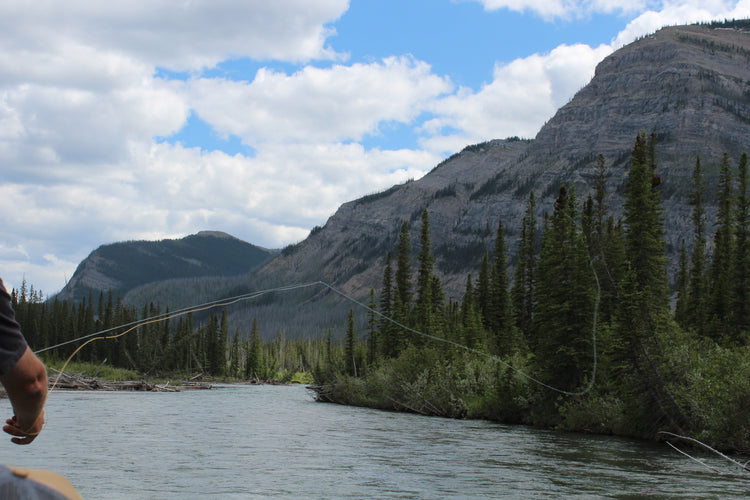
Home to vast expanses of untouched wilderness, Canada’s north is legendary among outdoor explorers for its beauty and magnitude. Pristine rivers run for thousands of kilometres through towering mountain ranges, deep canyons and barren tundra. Polar bears, muskoxen and caribou roam the land while falcons and eagles fly overhead. In the summer, the midnight sun means your adventures can carry you through the night, while the winter offers incredible views of the aurora borealis. With just a couple of major cities found in the region, this is truly a place where nature dominates, with a scattering of small Inuit communities providing the primary access to much of this wild land.
Northern Canada GPS Maps at a Glance
- Combining day-to-day navigation with enhanced outdoor recreation information, this product combines all of the northern territories into one title, covering all of Yukon, the Northwest Territories and Nunavut.
- Over 73,000 land and water geographic features help you navigate the landscape with the knowledge of a local.
- Lake bathymetry (depth contour) for popular fishing lakes in the Yukon.
- Over 25,500 km of our backroads network combined into one map, including over 19,200 km of routable roads.
- Industry leading contours and topographic relief
- Over 14,200 km of paddling routes for canoeing, kayaking and rafting.
- Marked Game Management Areas (GMAs), Wildlife Management Units (WMUs) and Wildlife Management Zones (WMZs) for hunters.
- Over 3,200 km of snowmobile trails, plus over 2,800 km of ATV trails and over 2,500 km of multi-use trails for hikers, mountain bikers, cross-country skiers and snowshoers.
- Hundreds of fishing lakes, rivers and streams and hundreds of national, territorial and municipal parks.
- Enhanced snowmobile route cartography for improved display.
- Thousands of new mile markers along railway corridors in Version 2019.
So Much More Than Just Maps!
Backroad Mapbooks’ industry-leading, Garmin-licensed Northern Canada GPS Maps are the most detailed, comprehensive and up-to-date GPS maps available on the market. Our GPS Maps are the maps of choice for recreation, industry and even search-and-rescue, with countless geographic and activity-based Points of Interest. Updated regularly, these GPS Maps are Garmin licensed for compatibility with Garmin GPS and Basecamp. Available in Micro SD format, these Northern Canada GPS Maps are easy to install and use and bring all the detail you have come to expect from a Backroad Mapbooks product directly to your GPS device or computer. Keep your adventure rolling with the latest topographic data, routable roads, Wildlife Management Units and Game Management Areas, multi-use trails, ice roads, campgrounds, national and territorial parks and much more. With these Northern Canada GPS Maps in hand, your options for adventure are limitless.
Northern Canada GPS Map Features
- Garmin licensed and compatible with Garmin GPSTM, BasecampTM, MapSourceTM and RoadTripTM.
- Includes all standard Garmin features such as Find tool, City Navigation and more
- Preloaded seamless topographic maps with the highest level of map detail available on select Garmin GPSTM units and BasecampTM.
- Compatible with the latest Garmin 66i unit and inReach technology.
- The most complete paddling route and snowmobile trail coverage available for Northern Canada.
- Extensive routable road network plus thousands of kilometres of multi-use trails for hikers, mountain bikers, cross-country skiers and snowboarders
- Includes National, Territorial and Regional Parks and Campgrounds.
- Features smart background and searchable Game Management Areas (GMAs), Wildlife Management Units (WMUs) and Wildlife Management Zones (WMZs) for hunters.
- Searchable BRMB descriptions and activity information for fishing, paddling, parks, trails and more.
- Extras like lake and stream fishing with boat launches, paddling access points and more.
- Thousands of searchable geographic land and water features.
- And much more!
Unique Road Classification
Unique to Backroad GPS Maps are our enhanced road classifications that help you distinguish highways from resource roads and secondary roads. This extra level of road classification helps you to know which roads can be driven in a car and which ones are best left for a four-wheel drive vehicle or ATV.
In addition, we offer more recreational points and symbols than any other map source. From RV accessible to backcountry campsites, hiking to snowmobiling trailheads, fishing to paddling access points, we have your adventure covered. Our area classifications include mines and work sites, First Nations reserves, wildlife refuges, restricted areas and host of other features that help you see where you can play.
Get More Roads and Trails
Boasting more roads and trails than any other GPS Map, our road tracking classifications allow you to easily distinguish highways from secondary roads and resource roads. Access over 25,500 km of roads, plus over 14,200 km (8,820 ft) of paddling routes for canoeing, kayaking and rafting. Additionally, we show you over 3,200 km of snowmobile trails, plus over 2,800 km of ATV trails and over 2,500 km of multi-use trails for hikers, mountain bikers, cross-country skiers and snowshoers.
Northern Canada Road and Trail Highlights
- Over 25,500 km of roads, including over 19,000 km of routable roads.
- Over 14,200 km of paddling routes for canoeing, kayaking and rafting.
- Over 3,200 km of snowmobile trails, plus over 2,800 km of ATV trails and over 2,500 km of multi-use trails for hikers, mountain bikers, cross-country skiers and snowshoers.
Land and Water Geographic Features
Unique to our Northern Canada GPS Maps are over 73,000 land and water features combined over three territories. These features act as known landmarks to help users navigate the landscape with ease. Land features include capes and peninsulas, islands, named mountains, valleys, sand bars, cliffs and more. We have also included Glacial Landforms including eskers, glacial moraine and debris, as well as tundra. Water features shown on the maps include bays, lakes and rivers, channels, rapids, coves, basins and more.
Northern Canada Custom POI Highlights
- 530 hunting areas across three territories
- 400 fishing lakes, rivers and streams
- Over 40 boat launch locations
- Over 260 trails for hiking, mountain biking, cross-country skiing and snowshoeing
- ATV trails with over 30 trailhead locations
- Snowmobile trails with 30 trailhead locations
- Close to 160 national, territorial and regional park locations
- Close to 50 backcountry campsites
- Close to 50 picnic areas
- Over 360 resource facilities
- Close to 50 winter recreation sites and downhill ski areas
- Over 110 wildlife viewing areas
- Close to 70 waterfalls
- Dozens of marinas
- Close to 150 paddling routes for canoers and kayakers complete with access locations and portages
Backroad Extras
Backroad Extras are where you will find all the POI information specific to our Backroad GPS Maps.
Northern Canada Categories:
- ATV-OHV trails
- Backcountry Camps
- Backroad Attractions
- Boat Launches
- Border Monuments
- Campsites
- Cities
- Fishing Lakes, Rivers and Streams
- Fishing Resorts/Outfitters
- Golf Courses
- Hot Springs
- Hunting Areas
- Huts
- Land Features
- Lodging
- Marinas
- Paddling Access
- Paddling Routes
- Parks – National, Territorial, Regional
- Picnic Areas
- Portage Locations
- Public Services
- Recreation Sites
- Resource Facilities
- Restaurants
- Rivers and Creeks
- Ski Areas
- Snowmobile Routes
- Trails
- Transportation Services
- Visitor Information
- Water Features
- Waterfalls
- Wildlife Viewing
- Winter Recreation
Updates
We are always looking for ways to improve our products. Whether it is map updates, new trails, or road closures, we welcome any new information and feedback.
To submit a map update, you will need the following information:
- Publication Year
- A .gpx file or .zip file (if submitting more than one gpx file at a time)
- Map Coordinate (if applicable)
- Your comments regarding the suggested change/s
If you have more than one file to submit, please do so by uploading a zipped file containing all the .gpx files. All tracks and waypoints received will earn points for free updates in your account.
Mises à jour
Nous cherchons continuellement à améliorer nos produits. Nous accueillons à bras ouvert toutes suggestions et informations à propos de mise à jour de carte, d'ajout de sentiers ou d'annonce de route fermée à la circulation.
Pour soumettre une demande de mise à jour d'une carte, il vous faudra les informations suivantes:
- Année de publication
- Un fichier .gpx ou .zip (si vous soumettez plus d'un fichier à la fois)
- Coordonnées de carte (le cas échéant)
- Vos commentaires et changements suggérés.
Si vous avez plus d'un fichier à soumettre, veuillez le faire sous forme de fichier zippé contenant tous les fichiers .gpx. Toutes les trajectoires et balises reçues vous feront gagner des points pour bénéficier de mises à jour gratuites de votre compte.